
Sighter App

Project Overview
Sighter – Collaborative UAP Observation & Data Collection App
App Type:
- Data Collection | Camera Capture | Map Data
Key Systems
- iOS | Objective-C
- Admin Portal | Laravel

Description
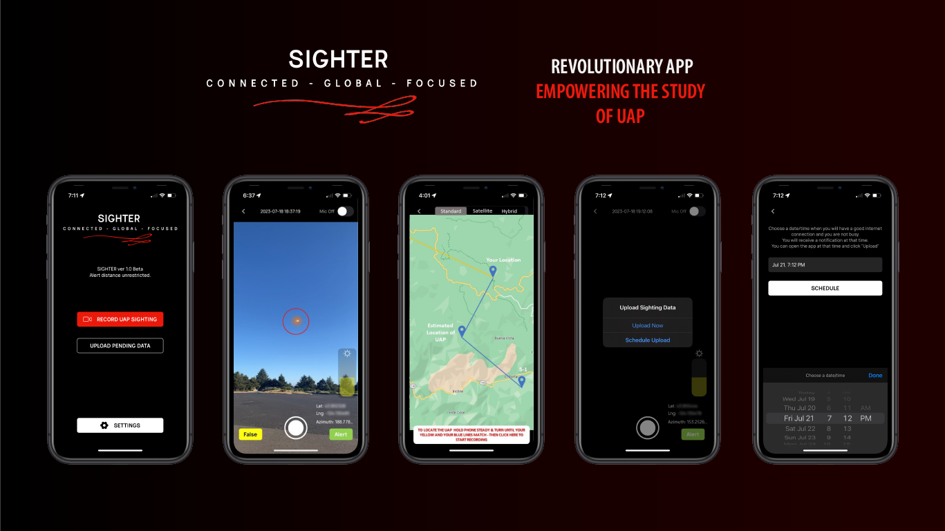
Sighter - Revolutionary App Empowering the Study of UAP
Sighter stands as a pioneering tool in the realm of UAP observation, combining user engagement with scientific rigor to advance our understanding of unexplained aerial events.
Sighter is an iOS mobile application designed to facilitate the real-time detection, documentation, and collaborative analysis of Unidentified Aerial Phenomena (UAP). Developed for both iOS, Sighter empowers users to capture sightings with precision, share alerts with nearby observers, and contribute to a centralized database for scientific research.
Challenges & Solutions
01
Real-Time Data Capture & Sharing
To ensure accurate and immediate documentation of UAP sightings:
Implemented a user-friendly interface that allows for quick video recording upon sighting.
Integrated GPS and compass functionalities to automatically log location, azimuth, and elevation data.
Enabled users to estimate and input the distance to the observed object, enhancing data richness.
02
Collaborative Observation Network
To foster a community-driven approach to UAP documentation:
Developed a notification system that alerts nearby users of new sightings, encouraging multiple observations of the same event.
Utilized triangulation algorithms to combine data from multiple users, improving the accuracy of object positioning and movement tracking.
03
Data Integrity & Validation
To maintain a high-quality dataset for research purposes:
Assigned unique identifiers to each sighting, consolidating data from all contributors.
Incorporated user polling mechanisms to assess the credibility of sightings and filter out false positives.
04
Backend Infrastructure & Data Management
To support scalable data storage and analysis:
Established a robust backend system for storing video footage and associated metadata securely.
Provided researchers with access to curated datasets for further study and analysis.
Results
- Successfully launched on both iOS and Android platforms, expanding the reach to a global user base.
- Created a dynamic network of observers contributing to a growing repository of UAP data.
- Facilitated the collection of high-quality, geotagged, and time-stamped data, aiding in the scientific study of aerial phenomena.